Oregon’s Newly Protected Waters

29 Feb 2012
By Rachel Nuwer, from the Mission Blue website
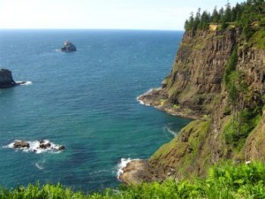
Image from wikitravel.org
Victory was sweet for some Oregonians last week. After pushing for a series of marine reserves and protected areas for over a decade, the Oregon State legislature approved Senate Bill 1510, which proposed three new marine reserves. This decision comes at the end of a long and sometimes tumultuous negotiation between fishermen, conservation groups, and coastal communities.

The three marine reserves—off Cape Perpetua, Cape Falcon, and Cascade Head—will extend three miles from the Oregon coast into the Pacific Ocean, encompassing some 109 square miles, or around 70,000 acres. Prior to the decision, Oregon had just two small pilot protected areas of about 9 square miles that went into full protection earlier this year. With the new additions, around 10 percent of Oregon’s territorial sea will be protected.

“The Governor is very pleased,” said Richard Whitman, Governor John Kitzhaber’s natural resources advisor. “We now have in place the network needed to test out this concept in Oregon,” he said. “We’ll see what the biological and economic effects of the system will be over the next ten years.”

The legislation calls for protected no-take marine reserves (about 3.4 percent) surrounded by buffers of marine protected areas (6 percent). The latter will allow for fishing of species like Dungeness crab and salmon, but trawling, harvesting forage fish, and offshore development will still be prohibited.

“We’re seeing a lot of signs of stress in the marine ecosystem off the Oregon coast,” said Ben Enticknap, the Pacific project manager for the non-governmental organization Oceana, a member of the Mission Blue coalition. “This is a chance to help build an understanding of what it means to have places untouched by human impacts.”

Enticknap has worked on the issue for over six years. He and his colleagues at Oceana identified and mapped Oregon’s important ecological areas and spoke to local communities to garner support. Along with a number of other organizations, Oceana has been “one of the main groups trying to work to advance this concept,” Whitman said, and added that Oregon’s Ocean Policy Advisory Council ultimately recommended the reserves in their current form.

Conservationists hope the marine reserves will help ailing species. Scientists catalogued 32 threatened and endangered species and populations that feed and migrate off the Oregon coast, such as salmon, smelt, humpback whales, and seabirds like the marbled murrelet. Oregon’s waters are home to three overfished species, including the slow-growing yelloweye rockfish, which lives to be over 100 years old. Under current management plans, the yelloweye rockfish population isn’t projected to recover fully until 2084.

Enticknap acknowledged that Oregon’s protected areas won’t be spared the impacts of climate change and ocean acidification, but he hopes that the networks can act as a kind of buffer, increasing the resilience of ecological communities impacted by those broad scale, global changes.

Around the world, no-take marine reserves typically increase the size of local marine life and also result in increased fish stocks. Marine animals nurtured in reserves spill over into adjacent areas, making the entire near-shore ecosystem more healthy and productive. This benefits the environment as well coastal communities who rely on the ocean economically.

Some fishermen are worried that the reserves will impact their livelihoods, though Enticknap pointed out that the 57-2 vote indicates that the “vast majority” of representatives and senators are in favor of the system. “There’s always going to be a vocal minority opposed to conservation,” he said, “but the majority of citizens, local businesses, and even fishermen support this and think it’s the right way to go.”

Whitman added that input from a broad range of stakeholders—from fishermen to recreational users—were considered in designing the reserves and protected areas.

Protections won’t go into effect immediately. The legislation calls for a two-year hiatus during which U.S. Fish and Wildlife Service scientists gather baseline data, funded by a $1.6 million dollar lottery grant. Over two summer field seasons, the scientists will collect data from all three future marine reserve sites, plus some control sites outside of those areas. In the meantime, fishermen can continue with business as usual.

People are happy with the outcome, Enticknap said, though conservationists recognize that the State’s southern coast still lacks protection. Last summer, Oceana conducted surveys of the area’s biodiversity with a remotely operated vehicle, observing corals, sponges and rockfish. Though Enticknap hopes to eventually establish a network of protected areas encompassing the full Oregon coast, he said that, for now, no imminent plans exist to make this goal a reality.

“Oregon values process as much as outcome, that’s a big thing I learned while working on this,” Enticknap said, adding that it’s been a challenge bringing so many people together to support the legislation. “We think the current network is a little thin, but it is going to protect marine habitats and biodiversity,” he said.

The Governor is “absolutely” planning to sign the bill, Whitman said, which should happen soon.

Meet our new Marxan trainers!

In December 2011, PacMARA held a Train the Trainers course in Edmonton, led by Dan Farr and Leif Olson. Five new instructors were successfully trained, including Norma Serra from PacMARA. We are very excited to put them to work teaching Marxan around the world.  Please visit the trainer profile page here.

In Photo (from left to right): Norma Serra (PacMARA staff), Dan Farr (Biota Research Ltd), Lief Olson (O2 Planning + Design Inc.), Tim Wilson (Compass Resource Management Ltd), Lindsay McBlane (Parks Canada), (bottom) Trevor Weins (Apropos Information Systems Inc), and Tom Habib (University of Alberta).

The 10 Commandments for Marxan in Planning

Through discussions about the role of Marxan in a systematic conservation and resource use planning process at the Huinay Scientific Field Station in Chile in August 2011, ten fundamental good practice guidelines for using a decision-support tool like Marxan have emerged.

They are available in PDF or below, in both English and Spanish:

“Ten Commandments for Marxan in Planning”

1. Decision support tools like Marxan can be very beneficial to planning processes;

2. These tools should only be used when they are needed; i.e. if the problem can be readily solved using conventional approaches, then that is preferable;

3. For spatial planning with many overlapping considerations, the use of decision support tools like Marxan is recommended;

4. When used in planning, Marxan should be driven by the agreed-upon goals and objectives of the planning process;

5. Good planning requires a mix of good science, governance, and communication / engagement with users;

6. Tools like Marxan require proper use of data and cannot be expected to provide solutions to problems for which there are no data.

7. Ultimately, sustainable development and planning is a social decision;

8. Tools like Marxan can assist in providing a pool of solutions and pointing out options that have not been considered before. It can highlight areas of conflict, as well as ‘win-win’ situations.

9. Used properly, Marxan solutions reflect due diligence in making use of available information, including available social and economic data; and

10. Local knowledge / concerns and other considerations (e.g. management practicalities) will mean that zoning decisions will differ in certain ways from those solutions produced by Marxan. In general the boundaries will be straighter with the shapes more regular (e.g. boxes).

“Diez Conclusiones en el uso de Marxan para la Planificación”

1. Herramientas de apoyo a las decisiones como Marxan pueden ser muy beneficiosas para los procesos de planificación;

2. Estas herramientas sólo se deberían utilizar cuando se necesiten; es decir, si el problema se puede resolver utilizando enfoques convencionales, entonces estos son preferibles;

3. La utilización de herramientas para la toma de decisiones como Marxan es recomendable para la planificación espacial con muchas consideraciones sobrepuestas;

4. Es importante que los objetivos y las metas del proceso de planificación sean acordadas previamente para guiar Marxan;

5. Una adecuada planificación requiere buena ciencia, política, y comunicación / inclusión de los usuarios;

6. Herramientas como Marxan requieren un uso adecuado de los datos y no se puede esperar que proporcione soluciones a problemas donde no existen datos;

7. En última instancia, el desarrollo sostenible y la planificación son una decisión social;

8. Herramientas como Marxan pueden proporcionar un grupo de soluciones y señalar opciones que no han sido consideradas con anterioridad. Pueden señalar áreas de conflicto y situaciones con ganancias para ambas partes [‘win-win’ situations].

9. Utilizado adecuadamente, las soluciones de Marxan pueden reflejar el ‘análisis adecuado’ [due diligence] de la información disponible, incluyendo los datos social y económicos; and

10. Los conocimientos y preocupaciones locales, además de otras consideraciones como la practicabilidad de la gestión, pueden generar que las decisiones de zonación locales difieran de las soluciones proporcionadas con Marxan.  En general, en estos casos los bordes de las zonas resultarán más rectos y con formas más regulares, como los cuadrados.

PacMARA Merchandise for SALE!

Looking for holiday presents?

Welcome to PacMARA’s new online store!
http://www.cafepress.ca/pacmara

Choose from a variety of PacMARA t-shirts, sweatshirts, totebags, mugs, hats, stickers, and magnets. Each purchase will benefit PacMARA, a charitable organization working to improve coastal and marine planning in BC and all of North America!

Thank you for your help.

New tools available to help beginning Marxan users

Are you looking for a tool to streamline Marxan analyses?

David Tellier from the Ontario Ministry of Natural Resources has developed scripts to reduce GIS technical difficulties and improve efficiency of data loading for Marxan projects!

The target audience for the scripts include:
– Marxan beginners
– Anyone using ArcGIS Desktop to assemble input data for Marxan
– Anyone using ArcGIS Desktop to generate summaries and maps for presentation of Marxan outputs

We are looking for Marxan users (particularly new users) for feedback on these scripts – please check them out here.
Question and comments for improvement can be submitted on the linked discussion site or emailed to info(at)pacmara.org.

Thank you for helping make Marxan more accessible!

“The Aquaculture Controversy in Canada” wins the K.D. Srivastava…

“The Aquaculture Controversy in Canada,” written by Nathan Young and Ralph Matthews of UBC, has just won the prize in honour of professor emeritus K.D. Srivastava, who was principally responsible for the reorganization and revitalization of UBC Press. It is awarded each year by the Publications Board of the Press to the author of a work of outstanding scholarly quality.

“The Aquaculture Controversy in Canada” discusses farming of aquatic organisms, one of the most promising but controversial new industries in Canada. The industry has the potential to solve food supply problems, but critics believe it poses unacceptable threats to human health, local communities, and the environment. This book is not about the methods and techniques of aquaculture but an exploration of the controversy itself. Rather than choosing sides, Nathan Young and Ralph Matthews present the controversy as a multi-layered conflict about knowledge, rights, and development. Comprehensive and balanced, this book addresses one of the most contentious public policy and environmental issues facing the world today.

Canadian MPA Network Framework Comments

What do you have to say?

Electronic Comment Form
Fisheries and Oceans Canada’s draft National Framework for Canada’s Network of Marine Protected Areas (MPAs) provides strategic direction for MPA design that will be composed of a number of bioregional networks. This is an important step towards meeting Canada’s domestic and international commitments to establish a national network of marine protected areas by 2012.

The National Framework outlines the proposed overarching vision and goals of the national network; establishes the network components, design properties, and eligibility criteria for which areas will contribute to the network; describes the proposed network governance structure; and provides the direction necessary to promote national consistency in bioregional network planning. The document has been drafted in collaboration with a federal-provincial-territorial government Oceans Task Group that reports to the Canadian Council of Fisheries and Aquaculture Ministers.

The current November 2010 version is posted for public review and comment. Click here to access the draft and tell DFO what you think about the framework. The closing date for input is 3 February 2011.

Predicting the future of oceans

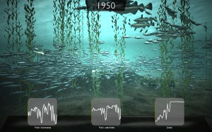
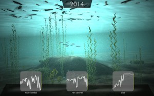
Daniel Pauly and Villy Christensen, of UBC’s Fisheries Centre, are leading a research project that will predict the future of the world’s oceans with 30 international marine scientists. The team will monitor the impact of human activities on seafood resources with 3-d gaming technology.

“As part of the program, international experts in fisheries, climate change, environmental policy, geospatial modeling, marine ecology and socio-economics will engage in research collaborations, capacity building and increasing public awareness about fish stock depletion.” The program will be funded by Japan’s Nippon Foundation’s Maritime Program. See the full UBC press release here, and news article here.

Researchers at the UBC Fisheries Centre have also just published an open-access paper on the rate of corporate fisheries expansion in the journal PLoS ONE.

Job Opportunities with PNCIMA

The Pacific North Coast Integrated Management Area (PNCIMA) Initiative’s aim is to ensure a healthy, safe, and prosperous ocean area by engaging all interested parties in the collaborative development and implementation of an integrated management plan for PNCIMA. Find out more here.

Contract announcements have been posted for a Planning Office Administrator and a Science Coordinator for the PNCIMA Initiative. View contract postings here and apply by January 14, 2011.

The Planning Office Administrator will coordinate the day to day work of communications, planning, GIS and other contracted staff in accordance with the approved PNCIMA work plan and budget. The Planning Office Administrator will operate under the direction of the Planning Office Process Management Team and Tides Canada with respect to budgets, financial management and contracting.

The Science Coordinator will work with the Planning Office to identify, articulate and fulfill the science and technical requirements for the PNCIMA initiative. The Science Coordinator will also provide coordination and support to the Marine Technical Advisory Team, a body of experts that will provide advice upon request to the PNCIMA initiative.